Loading
NorwayEurope
my city isStavanger
Wooden houses round the harbour, low hills, and water on three sides.
58.9700° N 5.7331° E
Neighbourhoods
- Holmen
- Straen
- Bergeland
- Blåsenborg
- Kannik
- Lagård
- Ledaal
- Eiganes
- Våland
- Paradis
- Kampen
- Lervig
the sun over Stavanger
58.97° N · Sun Path
Longest day 18 h 30 · shortest 6 h 10
Stavanger, Sun Path · The ChartThe lines
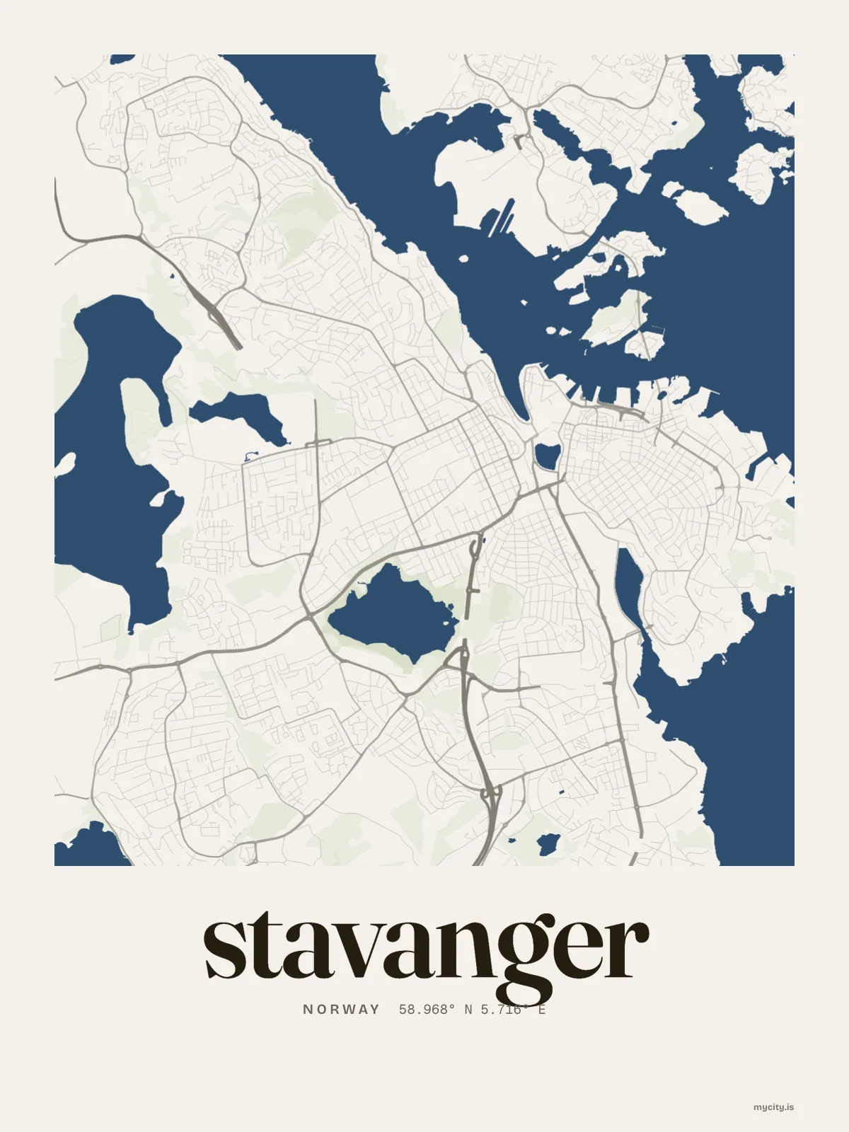
Stavanger, in our lines
Each of our lines, drawn again for Stavanger, for a wall or for a chest.
In words
Stavanger, set in type
From Stavanger's own names, set in the city's type: its neighbourhoods, its streets from A to Z and the sentence. Each one a print you can make yours.
About Stavanger
Narrow lanes of old wooden houses climb up from the harbour, and the sea reaches in on almost every side. Stavanger sits on a peninsula in the south-west of Norway, the main town of Rogaland.
Ready to buy · ships to United States
Stavanger in lines and in letters
01 · 7 date designs
A date of your own
Signed 58.970° N, 5.733° E and set like an invitation: the day you arrived in Stavanger, married there or moved away. You write the words.
See all 7 datesShow fewer
Loading
02 · 7 designs
Twelve neighbourhoods, one by one
Stavanger in words: the sentence, finished, every neighbourhood run together and its name built big. Madlaveien runs longest through the middle of town.
See all 7 designsShow fewer
Loading
03 · 6 designs
At 58° north
Stavanger, measured: the distance to somewhere else, its year, month by month and how far it is to everywhere else. London is 908 km away, as the crow flies.
See all 6 designsShow fewer
Loading
04 · 14 designs to wear and use
For every day
Stavanger on tees and mugs, made for you.
Ways in
Start from a moment in Stavanger.
Each one has the words, a pin, a date and a style already in place for Stavanger. Open it, then make every part yours.