Loading
CubaLatin America
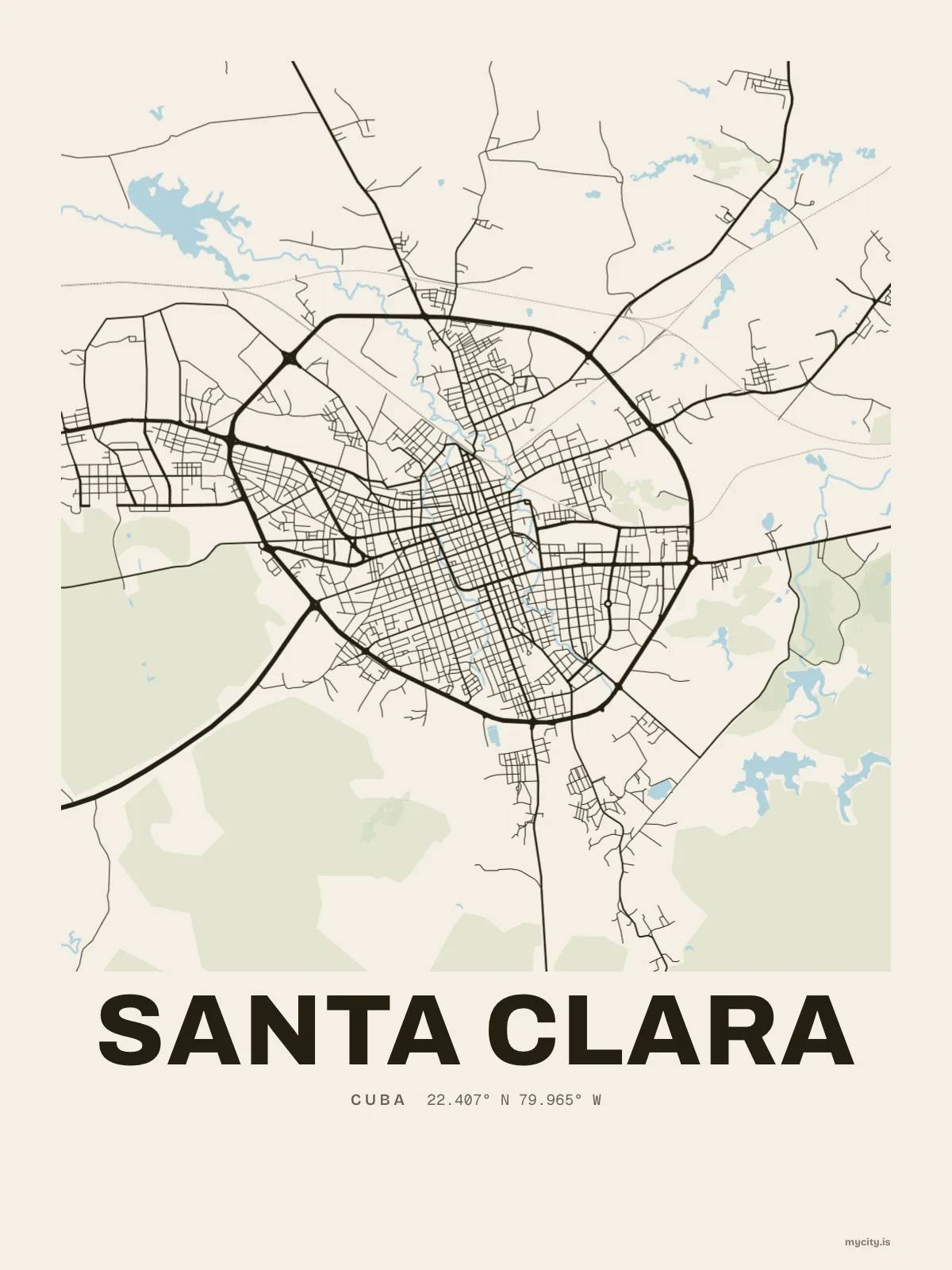
my city isSanta Clara
A central square, a loose grid of low streets, and a lone hill at the edge.
22.4069° N 79.9649° W
Neighbourhoods
- Capiro
- Santa Catalina
- Villa Josefa
- Sandino
- Chambery
- Escambray
- Loma de Belén
- Tenería
- Minerva
- San Daniel
- Osvaldo Herrera
- Virginia
Constellation
the neighbourhoods of Santa Clara
24 places, joined nearest to nearest
Ring yoursThe lines
Santa Clara, in our lines
Our own lines, set for Santa Clara. Each one comes on what you wear and what you hang.
In words
Santa Clara, word for word
From Santa Clara's own names, set in the city's type: its neighbourhoods, its streets from A to Z and the sentence. Each one a print you can make yours.
About Santa Clara
Low streets set in a loose grid, a central square in the middle, and a single hill rising at the edge of town. Santa Clara is a provincial capital in the middle of Cuba, with a tamarind in its founding story.
Ready to buy · ships to United States
Santa Clara in maps and words, to keep
01 · 7 designs
Twelve neighbourhoods, by name
Santa Clara in words: the sentence, finished, every neighbourhood run together and its name built big. Carretera Central runs longest through the middle of town.
See all 7 designsShow fewer
Loading
02 · 6 designs
By the numbers
Santa Clara, measured: the distance to somewhere else, its year, month by month and how far it is to everywhere else. Havana is 259 km away, as the crow flies.
See all 6 designsShow fewer
Loading
03 · 7 date designs
Keep the date
The day that made Santa Clara yours, set like an invitation and signed with its coordinates, 22.407° N, 79.965° W. You write the words.
See all 7 datesShow fewer
Loading
04 · 14 designs to wear and use
For every day
Santa Clara on tees and mugs, made for you.
Ways in
Start from a moment in Santa Clara.
Each one has the words, a pin, a date and a style already in place for Santa Clara. Open it, then make every part yours.