Loading
United StatesNorth America
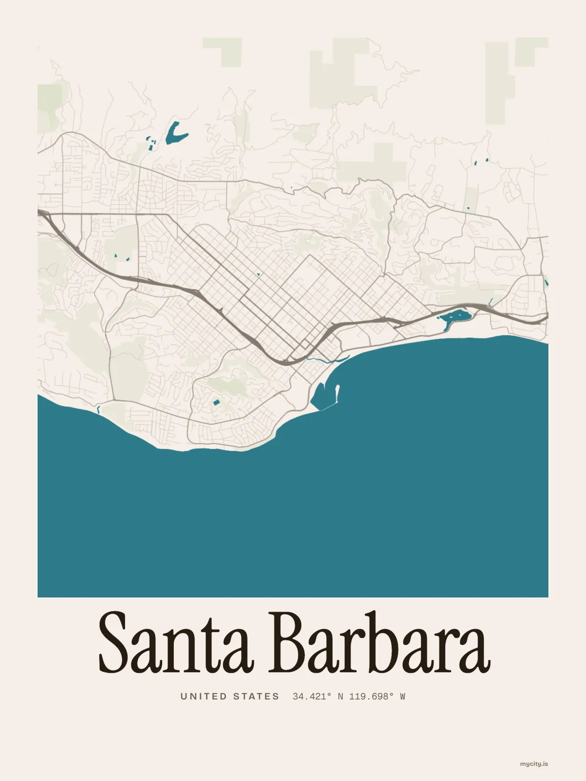
my city isSanta Barbara
A south-facing coast with the Santa Ynez Mountains rising right behind it.
34.4208° N 119.6982° W
Neighbourhoods
- Downtown
- Lower Eastside
- Upper Eastside
- The Riviera
- Mission Canyon
- The Westside
- The Mesa
- Alta Mesa
- Bel Air
- Samarkand
- San Roque
the sun over Santa Barbara
34.42° N · Sun Path
Longest day 14 h 30 · shortest 9 h 50
Santa Barbara, Sun Path · The ChartThe lines
Santa Barbara, in our lines
The lines we draw for every city, set in Santa Barbara's colours and type.
In words
Santa Barbara, in so many words
From Santa Barbara's own names, set in the city's type: its neighbourhoods, its streets from A to Z and the sentence. Each one a print you can make yours.
About Santa Barbara
White walls and tile roofs by design, sea breezes all year, and a ridge the locals call the Riviera. Santa Barbara faces the sun on a coast that runs east to west.
Ready to buy · ships to United States
Santa Barbara, framed or worn
01 · 6 designs
A grid turned 45°
Santa Barbara, measured: the distance to somewhere else, its year, month by month and how far it is to everywhere else. Most of its streets run on a grid turned about 45° off north.
See all 6 designsShow fewer
Loading
02 · 7 designs
Eleven of its neighbourhoods
Santa Barbara in words: the sentence, finished, every neighbourhood run together and its name built big. Alameda Padre Serra runs longest through the middle of town.
See all 7 designsShow fewer
Loading
03 · 7 date designs
Make a day of it
The day that made Santa Barbara yours, set like an invitation and signed with its coordinates, 34.421° N, 119.698° W. You write the words.
See all 7 datesShow fewer
Loading
04 · 14 designs to wear and use
Take it with you
Santa Barbara on tees and mugs, made for you.
Ways in
A day in Santa Barbara, set up to keep.
Each one has the words, a pin, a date and a style already in place for Santa Barbara. Open it, then make every part yours.