Loading
United StatesNorth America
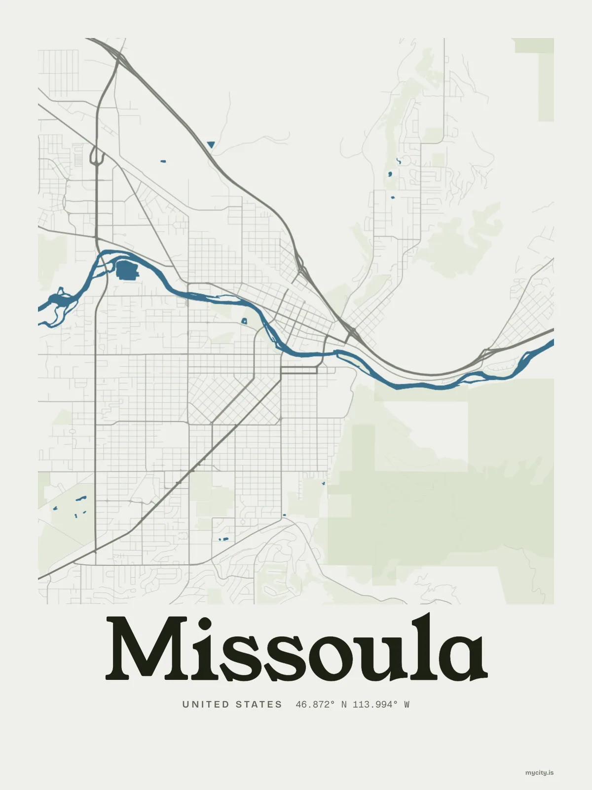
my city isMissoula
The hub of five valleys, on the bed of an ice-age lake.
46.8721° N 113.9940° W
Neighbourhoods
- Northside
- Southside
- Lower Rattlesnake
- Rattlesnake
- McCormick
- University Area
- South Hills
- Target Range
- Slant Streets
- Downtown
- East Pine Street
- East Missoula
the sun over Missoula
46.87° N · Sun Path
Longest day 15 h 55 · shortest 8 h 30
Missoula, Sun Path · The ChartThe lines
Missoula, in our lines
Each of our lines, drawn again for Missoula, for a wall or for a chest.
In words
Missoula, set in type
From Missoula's own names, set in the city's type: its neighbourhoods, its streets from A to Z and the sentence. Each one a print you can make yours.
About Missoula
Old shorelines stacked up the side of Mount Sentinel, a river through town, and a corner of downtown where the streets run on a slant. Missoula calls itself Zootown, fondly.
Ready to buy · ships to United States
Missoula, for the wall and the wardrobe
01 · 6 designs
North, south, east, west
Missoula, measured: the distance to somewhere else, its year, month by month and how far it is to everywhere else. Most of its streets run north–south or east–west.
See all 6 designsShow fewer
Loading
02 · 7 designs
Twelve neighbourhoods, by name
Missoula in words: the sentence, finished, every neighbourhood run together and its name built big. Stephens Avenue runs longest through the middle of town.
See all 7 designsShow fewer
Loading
03 · 7 date designs
The day it started
A day in Missoula, set like an invitation and signed 46.872° N, 113.994° W: the day you moved, married, met or arrived. You write the words.
See all 7 datesShow fewer
Loading
Ways in
A day in Missoula, set up to keep.
Each one has the words, a pin, a date and a style already in place for Missoula. Open it, then make every part yours.