Loading
United StatesNorth America
my city isLexington
Bluegrass all round, horse farms at the edge of town, and a creek under Vine Street.
38.0406° N 84.5037° W
Neighbourhoods
- Ashland Park
- Bell Court
- Chevy Chase
- Kenwick
- Mentelle Park
- Hartland
- Masterson Station
- Meadowthorpe
- Picadome
- Gardenside
- Cardinal Valley
- Idle Hour
- Lansdowne
- Andover Hills
- Southland Park
- Highlands
- Pasadena
- Garden Springs
- Stonewall
- Zandale
- Woodward Heights
- Elizabeth Street
Constellation
the neighbourhoods of Lexington
17 places, joined nearest to nearest
Ring yoursThe lines
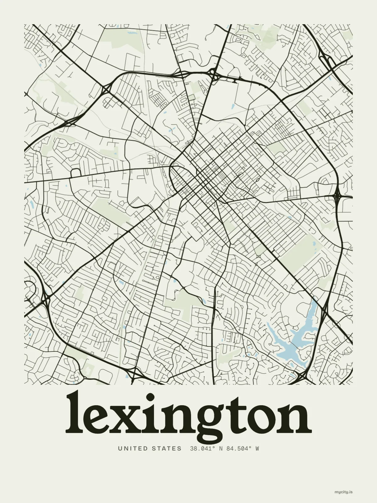
Lexington, in our lines
The lines we draw for every city, set in Lexington's colours and type.
In words
Lexington, in so many words
From Lexington's own names, set in the city's type: its neighbourhoods, its streets from A to Z and the sentence. Each one a print you can make yours.
About Lexington
Burgoo at a fundraiser, horse farms where the town stops, and four proper seasons. Lexington drew a line around itself in 1958 and kept the country on the other side.
Ready to buy · ships to United States
Lexington, printed for the wall and the street
01 · 6 designs
A grid turned 45°
Lexington, measured: the distance to somewhere else, its year, month by month and how far it is to everywhere else. Most of its streets run on a grid turned about 45° off north.
See all 6 designsShow fewer
Loading
02 · 7 designs
Name by name
Lexington in words: the sentence, finished, every neighbourhood run together and its name built big. Richmond Road runs longest through the middle of town.
See all 7 designsShow fewer
Loading
03 · 7 date designs
Since the day
A day in Lexington, set like an invitation and signed 38.041° N, 84.504° W: the day you moved, married, met or arrived. You write the words.
See all 7 datesShow fewer
Loading
04 · 14 designs to wear and use
Lexington, worn
Lexington on tees and mugs, made for you.
Ways in
Lexington, from the day that counts.
Each one has the words, a pin, a date and a style already in place for Lexington. Open it, then make every part yours.