Loading
United StatesNorth America
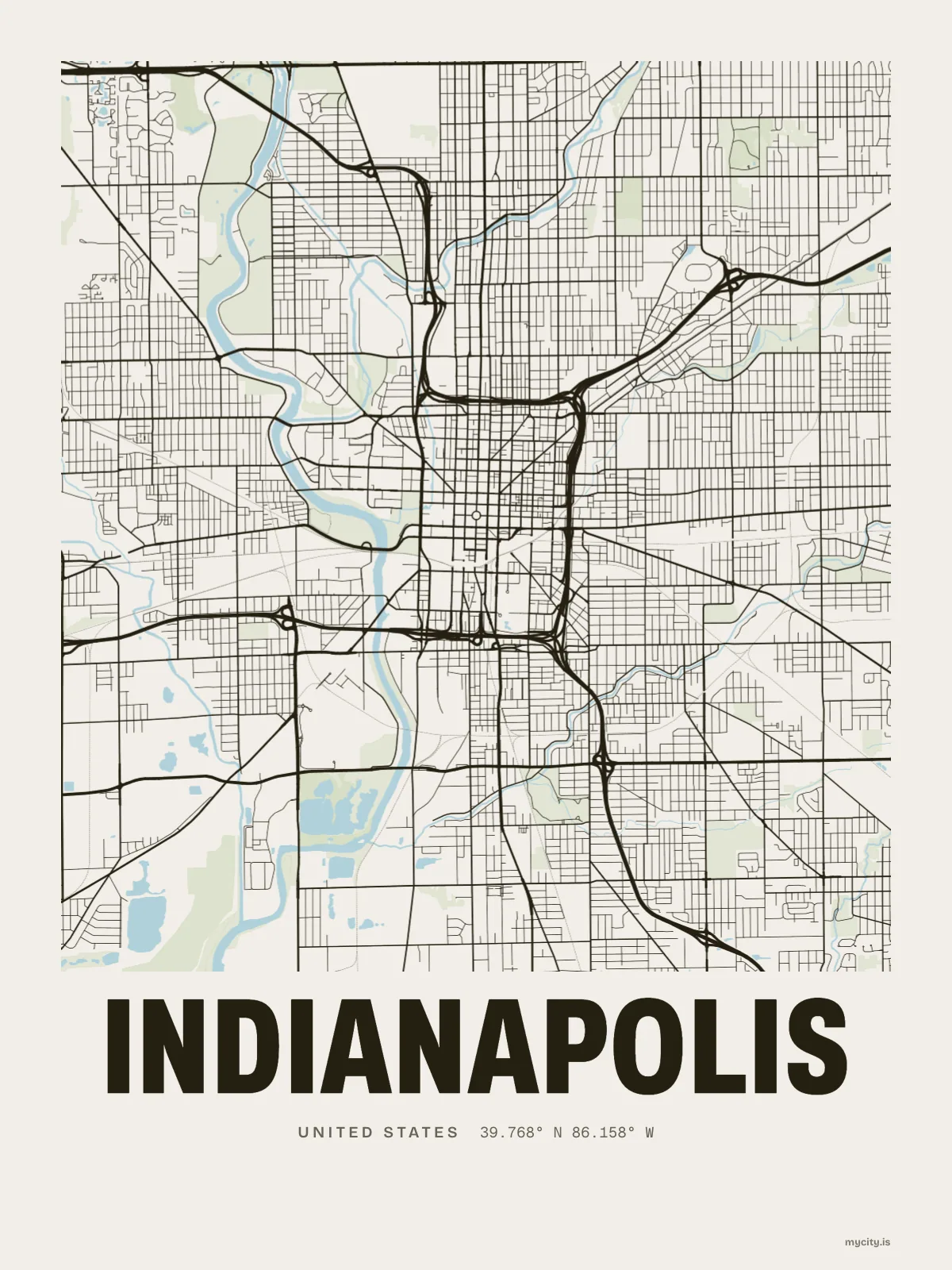
my city isIndianapolis
A mile-square plan around a circle, on a flat plain the ice sheets left behind.
39.7684° N 86.1581° W
Neighbourhoods
- Broad Ripple
- Irvington
- University Heights
- Castleton
- Eagledale
- Nora
- Cottage Home
- Fall Creek Place
- Fountain Square
- Fletcher Place
- Bates–Hendricks
- Butler–Tarkington
- Chatham–Arch
- Meridian-Kessler
- Mapleton-Fall Creek
- Haughville
- Riverside
- Woodruff Place
- Martindale–Brightwood
- Glendale
- Geist
- Bridgeport
- Augusta
the sun over Indianapolis
39.77° N · Sun Path
Longest day 15 h 00 · shortest 9 h 20
Indianapolis, Sun Path · The ChartThe lines
Indianapolis, in our lines
Our lines, made for Indianapolis: on a print, a tee, a hoodie or a mug.
In words
Indianapolis, in so many words
From Indianapolis's own names, set in the city's type: its neighbourhoods, its streets from A to Z and the sentence. Each one a print you can make yours.
About Indianapolis
A breaded pork tenderloin, sugar cream pie after, and avenues that lead back to the circle. Indianapolis was drawn on paper before it was built, and it still reads like the plan.
Ready to buy · ships to United States
Indianapolis, mapped and lettered
01 · 6 designs
North, south, east, west
Indianapolis, measured: the distance to somewhere else, its year, month by month and how far it is to everywhere else. Most of its streets run north–south or east–west.
See all 6 designsShow fewer
Loading
02 · 7 designs
Every street, named
Indianapolis in words: the sentence, finished, every neighbourhood run together and its name built big. West Michigan Street runs longest through the middle of town.
See all 7 designsShow fewer
Loading
03 · 7 date designs
The date that counts
A day in Indianapolis, set like an invitation and signed 39.768° N, 86.158° W: the day you moved, married, met or arrived. You write the words.
See all 7 datesShow fewer
Loading
04 · 14 designs to wear and use
For every day
Indianapolis on tees and mugs, made for you.
Ways in
Start from a moment in Indianapolis.
Each one has the words, a pin, a date and a style already in place for Indianapolis. Open it, then make every part yours.